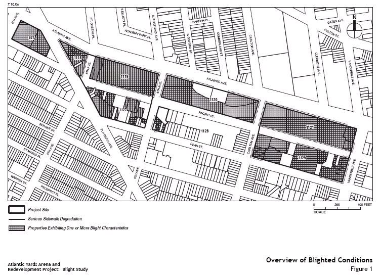
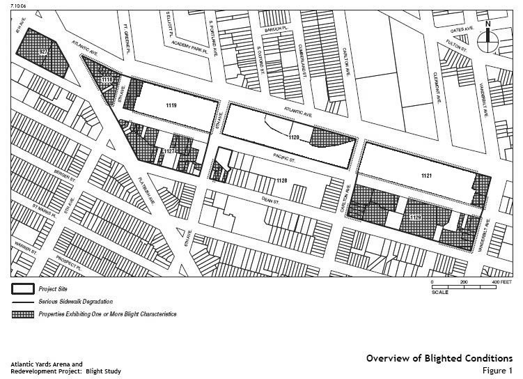
 The blight map compiled by the Empire State Development Corporation (ESDC) suggests a nearly unbroken skein of blight on the proposed 22-acre Atlantic Yards footprint, as indicated by the map at right. According to the ESDC's Blight Study, the 22-acre project area “is characterized by blighted conditions that are unlikely to be removed without public action.”
The study states that, in the blocks beyond the railyards, "51 of the 73 parcels on the project site (70 percent) exhibit one or more blight characteristics, including: buildings or lots that exhibit signs of significant physical deterioration, buildings that are at least 50 percent vacant, lots that are built to 60 percent or less of their allowable Floor Area Ratio (FAR) under current zoning; and vacant lots."
Much of that can be challenged, as I've noted, which means some of the dark cross-hatching could be removed from the map.
The railyard as villain?
But what about the railyard? The study states, "This continued blight is due in part to the presence of the active, but below-grade open rail yard that creates a significant visual and physical gap in the urban landscape of the Atlantic Terminal area and creates a sense of desolation on the project site."
So, imagine what the blight map would look like if it began from the assumption that the railyard was not, in fact blighted.
 Last month, on the Brian Lehrer Show, Develop Don't Destroy Brooklyn attorney Jeff Baker disputed the ESDC's determination:
They’re counting as an element of blight, the Vanderbilt Yard railyard. I’m not sure it qualifies as blight; it’s an active use by the MTA and LIRR… There’s been no effort by any state or city authority for at least the last 30 years to develop it. It could also be considered an asset.
Comments
Post a Comment