 What happened to the Coney Island site next to Keyspan Park for the proposed Brooklyn arena? After all, that was Borough President Marty Markowitz's original idea, which he maintained fondly through early 2003. (Graphic from the Brooklyn Papers 1/31/04).
Despite that, the Empire State Development Corporation, in the Project Description chapter of the Draft Environmental Impact Statement, dismisses the much-discussed Coney option, thanks to project guidelines supplied by developer Forest City Ratner.
Feasibility study
The DEIS cites a 1974 city-sponsored preliminary feasibility study for the Brooklyn Sports Complex, a 15,000-seat arena that could accommodate professional basketball and other sports, and also supply sports facilities for local school and college athletic programs, and community athletic facilities. Multiple sites were suggested, especially those around Downtown. The DEIS recounts:
Of the five downtown sites considered, plus Fulton Ferry, only two appeared to meet the key criteria for size and accessibility. Both sites were listed in ATURA. One is the current site of the Bank of New York Tower and the two shopping centers: Atlantic Center and Atlantic Terminal. The other is the site currently being proposed for the Atlantic Yards Arena. In the 1974 report, the arena site extended from the corner of Flatbush and Atlantic Avenues eastward along Atlantic Avenue to Carlton Avenue. The site extended southward along Flatbush Avenue to Dean Street, continued eastward to 6th Avenue, then northward to Pacific Street and eastward to Carlton Avenue. In short, the site encompassed the arena block and Block 1120.(Emphasis added.)
 Note that the 9.5-acre site (right, in red) that was proposed for the arena is not the same as the 22-acre site proposed for the Atlantic Yards project, which would incorporate two large blocks east of Carlton Avenue to Vanderbilt Avenue, and also encompass the streetbed of Pacific Street. The project also would include a rectangle of land 100 feet east of Sixth Avenue between Pacific and Dean streets, as well as Site 5, the wedge west of Flatbush Avenue where it meets Atlantic and Fourth avenues, and Pacific Street.
 What's different
The DEIS continues:
The desire for a first-class professional team continues to be strong in Brooklyn. The overall benefit of an arena for such a team as a focal point for investment and development in Downtown Brooklyn remains an opportunity. The site that could accommodate such development, identified more than 30 years ago, is still underutilized today. What is different now is the presence of a developer and team owner willing to locate an arena and related development on the project site.
Note the difference, again, between the "project site" and the "arena site." And also note that had the site been put out for bid, many developers might have made proposals.
Sports facilities themselves are not necessarily spurs to development and investment; the main reason the Brooklyn arena is projected as successful is that it would absorb revenues from New Jersey, current home to the Nets.
Sites considered--and dismissed
The DEIS states that Forest City Ratner checked out other sites in Brooklyn, under the following siting criteria:
• The site should be large enough to accommodate an arena with a minimum footprint of 240,000 sf. In addition, the project site footprint should also allow for other mixed-use development. Recent experience with new arenas, such as the MCI Arena in Washington, D.C., and San Diego’s PETCO Park (the signature component of its “Ballpark District”), has shown that these facilities thrive in combination with a strong mix of urban land uses, e.g., offices, shops, restaurants, and housing.
• The site should be readily accessible to mass transit, which could serve the arena patrons, workers, residents, and other visitors who would travel to the site regularly.
• The site should be close to or within a Central Business District, so that the office component of the mixed-use development would add to the critical mass of business activity.
• The site should have access to appropriate infrastructure—transportation, roads, sewer, water, etc.—to support the mixed-use development.
• The site should be large enough and close enough to major arterial roadways to accommodate truck deliveries for a range of arena events.
• The site shape and size should be adequate to provide security and access control around and beneath the arena and related development.
 Note that Coney Island would seem to fit nearly all of these criteria, except for the item regarding a Central Business District (CBD). But, as I've pointed out, the office component of the Atlantic Yards plan has diminished by two-thirds, so proximity to a CBD would be less crucial. In Coney Island, the mixed-use aspect could emphasize entertainment and recreation.
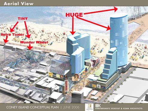
Indeed, Thor Equities has recently proposed a 10-acre condo/hotel/entertainment venue, though the renderings released (right) were apparently preliminary.
 What about Coney?
The DEIS dismisses the sites considered in the 1974 study. The Brooklyn Navy Yard would displace active businesses. Other sites would be too small or are no longer available. The Coney Island site is unavailable, because it "is now home to KeySpan Park."
That was indeed the original site proposed. However, after KeySpan park was announced, local advocates, including Borough President Markowitz, shifted their sights to another site, next door in the vast parking lot serving the antiquated Abe Stark rink, as noted in the top graphic. That effort goes unmentioned in the DEIS.
The AY site?
The DEIS winds up:
This leaves only Site 1a, which, as noted above, covers the proposed arena site plus the block on the south side of Atlantic Avenue between 6th Avenue and Carlton Avenue. Although ultimately project planners concluded that this site plus the two blocks to the east (from Carlton to Vanderbilt Avenues between Atlantic Avenue and Dean Street) would be best for the proposed project, they considered variations in this general location in response to community suggestions.
This fudges the difference between the previous plan and the Atlantic Yards plan, which would be more than twice as big. The Atlantic Yards plan encompasses two large blocks east of Vanderbilt Avenue between Pacific and Dean streets so the developers could build housing.
What about variations?
Forest City Ratner, the DEIS says, did consider building the arena at another nearby location:
One was to build the arena on a span over Atlantic Avenue. This would require that the base of the arena be at least 20 feet above street level, so that the entire structure would appear larger than an at-grade building and would hover over the street and be visible from long distances. The elevation of the arena would create serious operational problems—loading/unloading would be a major hardship and keeping the arena secure when it sits above an active major thoroughfare would also be problematic.
The concern about security for an arena built over Atlantic Avenue is legitimate; after all, an arena would be a target. But the DEIS doesn't discuss a simpler solution that was also proposed and dismissed: building the arena at the site of the Atlantic Center mall. Forest City Ratner apparently plans to build towers over that property.
The DEIS continues:
The project planners also considered the possibility of building the arena at grade in the bed of Atlantic Avenue while relocating the street to the south above the Vanderbilt Yard. While the challenge of building over an active railway tunnel and relocating major utilities could be met, this alternative would not produce a footprint large enough for both the arena and related development. The realignment of the street would break up the site, so that development parcels would be fragmented. This arrangement would also inhibit implementation of a comprehensive master plan, with cohesive design and a site plan that provides substantial contiguous publicly accessible open space. Furthermore, this realignment would bring Atlantic Avenue, one of the borough’s major thoroughfares, farther from the commercial uses to the north and closer to the residential neighborhoods to the south.
It was clear after consideration of alternative sites that only the project site would be large enough to accommodate a cohesive, comprehensive development containing the arena and a mix of synergistic uses, while offering extraordinary transportation access, proximity to a Central Business District, and substantial publicly accessible open space designed to foster pedestrian activity and promote connections with the surrounding neighborhoods.
This reads like a predetermined conclusion. After all, open space that "promote[s] connections with the surrounding neighborhoods" can only do so at a site that serves as a transition between neighborhoods rather than a site within a neighborhood.
Alternatives & questions
However, even within the general plan proposed, there are alternative locations or configurations for the arena--moved slightly east, so streets would not be demapped, as the Municipal Art Society has proposed, or moved toward Vanderbilt Avenue, as in Doug Hamilton's Pacific Plan. But the DEIS is written to reach certain conclusions, so the conclusions are not unexpected.
It could just have easily acknowledged that the publicly accessible open space is too little for the expected population and that the demapping of streets might stymie connections with the surrounding area.
And the size of the project may have just as much to do with selling sufficient market-rate housing to ensure the developer's profits than to "accommodate a cohesive, comprehensive development."
Comments
Post a Comment