 I wrote yesterday how the photograph (right) the Times used to illustrate its Atlantic Yards City section cover story failed to depict the proposed site. What could the Times have done differently?
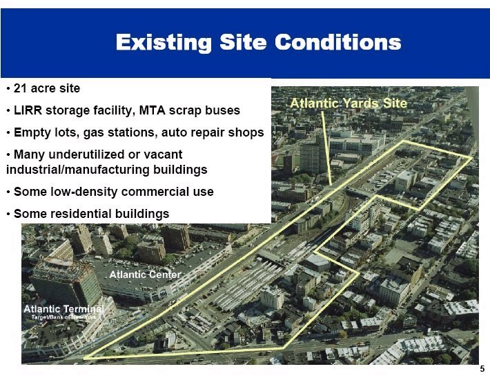
Well, the newspaper could've taken a cue from the 5/26/05 presentation by Forest City Ratner to the City Council, which at least outlined the then-21-acre site. The two slides with text below are taken from that presentation. (Since then, another acre has been added at the west end, crossing Flatbush Avenue.) Forest City Ratner's descriptions are, of course, contestable, but at least their graphic shows the outline of the site, including the public streets that would be demapped.
 The Times photo was apparently taken looking west from the Newswalk, the tallest building in the wedge cut out of the footprint, between 6th and Carlton avenues and Pacific and Dean Streets.
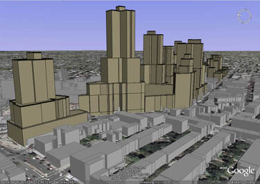
The building is minuscule compared to the proposed project. Check the Newswalk building at left-center near the top in the graphic (right). The rendering was produced by the Environmental Simulation Center for the Council of Brooklyn Neighborhoods (and subsequently adapted to emphasize Newswalk).
The simulation center produced massing models, from four different perspectives, of not just the Atlantic Yards plan but three alternatives. At the bottom, below the two Forest City Ratner slides, is another rendering by the simulation center. Note that a few buildings have since been cut in height.

Comments
Post a Comment