Yesterday, I helped lead a tour of bloggers and photographers around the Atlantic Yards footprint and beyond. (It was the brainchild of Lumi Rolley of NoLandGrab.) You can see some photos at the Flickr Atlantic Yards photostream. In trying to explain the evolution of the site and its environs, it's important to consider what came before.
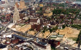 As I wrote in March 2006, Forest City Ratner’s Atlantic Yards proposal must be seen in context with other nearby projects, many of which did not come into fruition until the past decade, after the area rebounded economically. The blocks north and west of the the railyard--the Atlantic Terminal Urban Renewal Area (ATURA)--have been in various stages of decline, clearance, and renewal.
As the photo above (taken sometime in the late-80s to early 90s, and part of a Forest City Ratner presentation to City Council) suggests, large lots of land north of Atlantic Avenue (the northern border of the railyards) were scars themselves, decades after urban renewal began. Then came the Atlantic Center and Atlantic Terminal malls, and housing developments like Atlantic Commons. Land had to become scarce and costly enough for a developer to target the railyard, which requires a platform for construction. Also, the railyard function must be moved.
Vacant lots
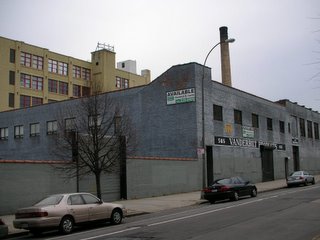 Also, the project site contains several vacant lots, and the number increases as buildings are demolished. In December 2005, a few months before Forest City Ratner gained permission for "emergency" demolitions (a contested issue) of five properties it owned, I took a picture of this building at the northeast corner of Dean and Carlton avenues. The interior, according to the analysis performed by Forest City Ratner's engineer, was in dangerous condition. A judge rejected a challenge, saying the decision by the Empire State Development Corporation to approve the demolitions didn't have to be confirmed. Now, it's a field of rubble, "facts on the ground" that argue for some kind of development.
Fortunately, several photographers have been taking pictures of the Atlantic Yards site and environs. They include Tracy Collins, Adrian Kinloch, Dave (Dope on the Slope) Kenny, Jonathan Barkey (notable for these dramatic photosimulations), Nathan Kensinger, Amy Greer, and Bob Guskind. One of the earliest collections--which captures several long-gone ghosts--was done by Kevin Walsh of Forgetten NY in December 2005.
Arbitrary blight
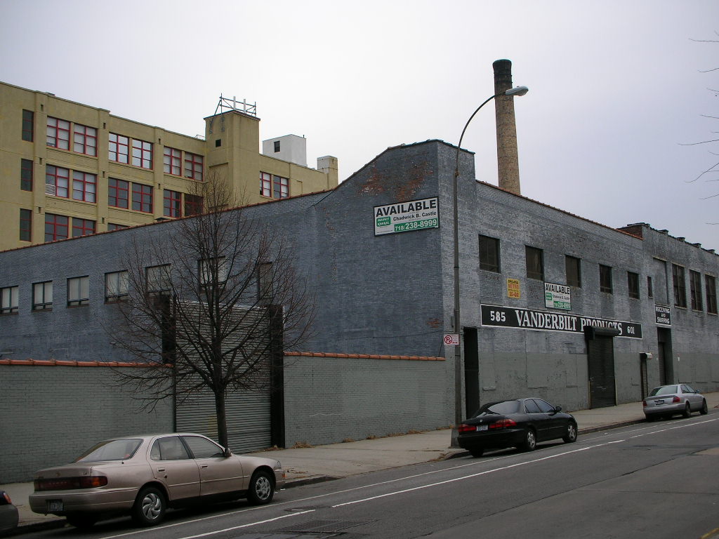
 One contentious issue involves the outline of the Atlantic Yards footprint, notably the 100 feet of the block between Pacific and Dean streets, just east of Sixth Avenue. Is that because the buildings are, in fact, blighted, and the rest of the block is in much better shape, as a lawyer for the Empire State Development Corporation argued last month in court? Or is it because the developer needs that plot of land for parking and construction staging?
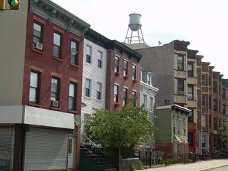
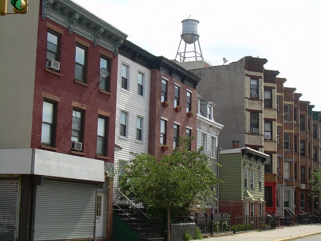
I took the photo at right last August. Today, visitors on the Brownstone Brooklyn Garden District Garden Walk will get a chance to see gardens in the backyards of two properties slated for demolition.
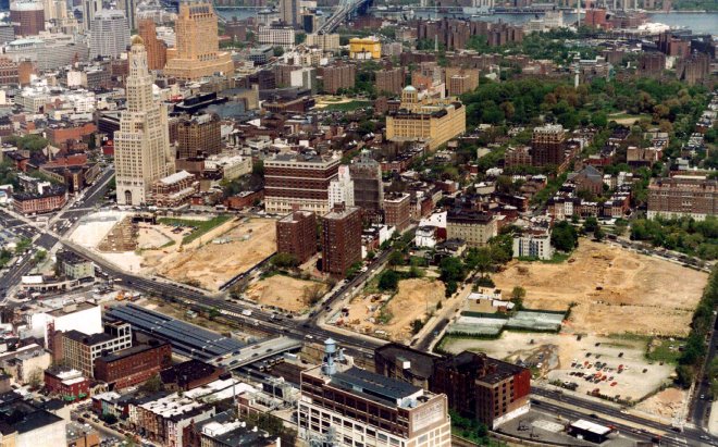 As I wrote in March 2006, Forest City Ratner’s Atlantic Yards proposal must be seen in context with other nearby projects, many of which did not come into fruition until the past decade, after the area rebounded economically. The blocks north and west of the the railyard--the Atlantic Terminal Urban Renewal Area (ATURA)--have been in various stages of decline, clearance, and renewal.
As the photo above (taken sometime in the late-80s to early 90s, and part of a Forest City Ratner presentation to City Council) suggests, large lots of land north of Atlantic Avenue (the northern border of the railyards) were scars themselves, decades after urban renewal began. Then came the Atlantic Center and Atlantic Terminal malls, and housing developments like Atlantic Commons. Land had to become scarce and costly enough for a developer to target the railyard, which requires a platform for construction. Also, the railyard function must be moved.
Vacant lots
 Also, the project site contains several vacant lots, and the number increases as buildings are demolished. In December 2005, a few months before Forest City Ratner gained permission for "emergency" demolitions (a contested issue) of five properties it owned, I took a picture of this building at the northeast corner of Dean and Carlton avenues. The interior, according to the analysis performed by Forest City Ratner's engineer, was in dangerous condition. A judge rejected a challenge, saying the decision by the Empire State Development Corporation to approve the demolitions didn't have to be confirmed. Now, it's a field of rubble, "facts on the ground" that argue for some kind of development.
Fortunately, several photographers have been taking pictures of the Atlantic Yards site and environs. They include Tracy Collins, Adrian Kinloch, Dave (Dope on the Slope) Kenny, Jonathan Barkey (notable for these dramatic photosimulations), Nathan Kensinger, Amy Greer, and Bob Guskind. One of the earliest collections--which captures several long-gone ghosts--was done by Kevin Walsh of Forgetten NY in December 2005.
Arbitrary blight
 One contentious issue involves the outline of the Atlantic Yards footprint, notably the 100 feet of the block between Pacific and Dean streets, just east of Sixth Avenue. Is that because the buildings are, in fact, blighted, and the rest of the block is in much better shape, as a lawyer for the Empire State Development Corporation argued last month in court? Or is it because the developer needs that plot of land for parking and construction staging?
I took the photo at right last August. Today, visitors on the Brownstone Brooklyn Garden District Garden Walk will get a chance to see gardens in the backyards of two properties slated for demolition.
Comments
Post a Comment